USFA: Investigation of MODIS-Detected Fires in NFIRS

Using MODIS data as a means for identifying wildfire incidents that may be missing from NFIRS


Investigation of MODIS-Detected Fires in NFIRS8.


United States Fire Administration

Moderate Resolution Imaging Spectroradiometer (MODIS)1 is a satellite-based instrument used to collect data about features on the Earth’s surface.

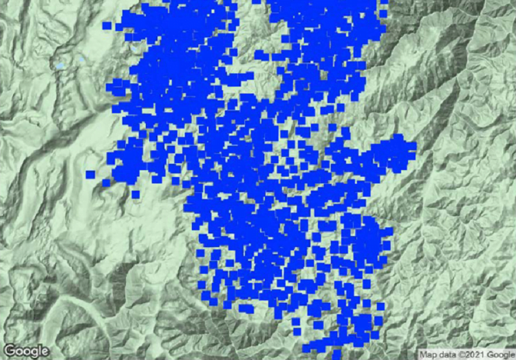
Scientists have developed algorithms to analyze that data to detect active fires. Researchers David T. Butry and Douglas S. Thomas published a paper in 20172 that compared the MODIS active fire data for California from 2003 to 2014 to wildfire incident data collected by the U.S. Fire Administration’s (USFA’s) National Fire Incident Reporting System (NFIRS) and found that only 32% of the MODIS-detected fires could be matched to an NFIRS incident.

See also  San Diego (CA) Tries a Different Approach to Fire Prevention: A New Spray on Dry Brush

In conducting this analysis, USFA’s goal was to apply a variation of Butry and Thomas’s MODIS/NFIRS fire incident matching process at the national level to determine if the same proportion of data could be matched in the rest of the U.S. Additionally, as a path to improving NFIRS reporting, it was thought that this could be a first step in determining the feasibility of using MODIS data as a means for identifying wildfire incidents that may be missing from NFIRS.

Using geocoded 2017 NFIRS data for all fire incidents in the U.S., USFA found that only 1.1% of the MODIS observations (or 1.6% of MODIS-identified incidents) occurred within 1 kilometer and 24 hours of any NFIRS-reported incident. It was determined that 6.4% of MODIS-identified incidents occurred within national parks and national forests, grasslands, and wilderness areas, but only a handful of these incidents appear in NFIRS data. As for the remaining unmatched MODIS-identified incidents, it is uncertain whether they occurred in other public lands; were small, controlled unreported fires; or were false positives.

See also  California Faces 18 Blazes in Worst Wildfire Season

Read The Report

Topics

Subscribe to Our Monthly Newsletter

Stay in the loop with our wildland newsletter.

Using MODIS data as a means for identifying wildfire incidents that may be missing from NFIRS       United States Fire Administration Moderate Resolution Imaging Spectroradiometer (MODIS)1 is a satellite-based instrument used to collect data about features on the Earth’s surface. Scientists have developed algorithms to analyze that data to detect active fires. Researchers […]

Get The Wildland Firefighter Newsletter

Related Articles

WA Lawmakers Slash Wildfire Budget in Half

WA Lawmakers Slash Wildfire Budget in Half

Isabella Breda - The Seattle Times May 8—CAMP CAMREC, Chelan COUNTY — The last fire to burn this forest was started by drip torches. Fingers of flame ignited the underbrush last fall, clearing fuels that could supercharge a wildfire. In a tour of the burn area last...

Wildfires Burn Thousands of Acres on Tribal Lands in ND

Wildfires Burn Thousands of Acres on Tribal Lands in ND

By JACK DURA Associated Press BISMARCK, N.D. (AP) — Crews have been fighting at least 16 wildfires throughout North Dakota in the last several days, including several large fires still burning Tuesday across wooded areas and grasslands on the Turtle Mountain...

NC Fire Grows to 1,300 Acres; Burn Ban Implemented

NC Fire Grows to 1,300 Acres; Burn Ban Implemented

Martha Quillin - The Herald (Rock Hill, S.C.) (TNS) A wildfire in Brunswick County that started Friday, May 2, is the largest of dozens of fires crews are working to contain across North Carolina. Weekend rains helped with some of the fires, but much of the state...