Wildfire has burned over 4,400 acres
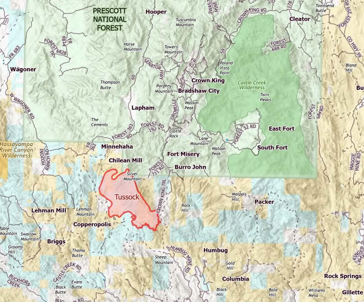
Tussock PIO Map May 11, 2021 (InciWeb)
CROWN KING, Ariz. (AP) — A wildfire burning in brush and grass in a sparsely populated area of central Arizona hill country continues to grow but no additional evacuation notices have been issued, officials said Tuesday.
The fire that started Saturday about seven miles (11 kilometers) southwest of Crown King had burned 4,421 acres (18 square kilometers) as of Tuesday morning, according to a statement released by fire managers.
“Weather conditions will continue to challenge firefighters with high temperatures, low humidity, and higher winds anticipated this week,” the statement said.
No containment around the fire’s perimeter has been achieved but no structure damage was reported as cause of the fire remained under investigation , according to the statement.
InciWeb: Tussock Fire Updates
The Yavapai County Sheriff’s officials said Sunday’s evacuation orders remained in effect for the Minnehaha, Fort Misery and Horsethief Basin areas.
Residents of the unincorporated community of Crown King have been advised to prepare for possible evacuation.
Elsewhere, the Arizona Department of Transportation on Monday reopened U.S. 60 east of Globe. The highway had been closed because of a wildfire reported contained around 51% of its perimeter as of Monday night.
All contents © copyright 2021 The Associated Press. All rights reserved.