Feds start pilot program using smartphone apps to alert fliers of restrictions
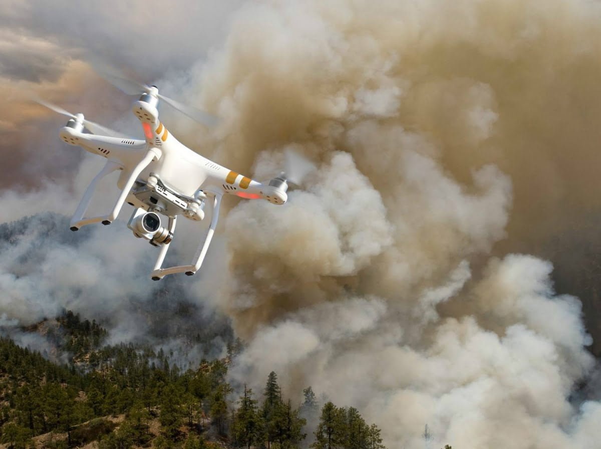
A drone flying over a wildfire. (Bureau of Land Management photo)
KEITH RIDLER, Associated Press
BOISE, Idaho (AP) — The first national system intended to prevent hobby drones from interfering with planes and helicopters fighting wildfires has launched, federal authorities say.
The U.S. Interior Department announced the kickoff of the pilot project Monday that uses a smartphone app and real-time wildfire information to create virtual boundaries, or geofences, that drones can’t cross.
Officials say drones colliding with firefighting aircraft could be catastrophic. Planes and helicopters have been grounded numerous times this year because of drones, most recently on Sunday in Southern California where 10,000 homes are threatened by fire. Earlier this month authorities arrested a man they say flew a drone over a Northern California wildfire and grounded firefighting aircraft.
“We believe this program, which uses the global positioning system to create a virtual barrier, will move us one step closer to eliminating this problem for wildfire managers,” Mark Bathrick, director of the Interior Department’s Office of Aviation Services, said in a statement.
The Interior Department developed the system with DJI, the world’s largest civilian drone-maker, and two other companies that specialize in offering navigational information to drone fliers, AirMap and Skyward.
Specifically, the Interior Department allows AirMap and Skyward to get the latest wildfire information directly from the federal agency’s Integrated Reporting Wildland-Fire Information program.
That information is then immediately pushed to drone pilots through apps on their smartphones, with the smartphones themselves typically used to navigate in combination with the drone’s GPS.
DJI has its own app called DJI GO. AirMap pushes the Interior Department’s wildfire flight restriction information to DJI. DJI uses it as a safety feature that prevents its drones from flying in temporary flight restrictions at wildfires. It even prevents DJI drones from taking off in wildfire restricted areas. The system can be overridden by those authorized to fly over a wildfire.
“This enhancement … will help prevent DJI drones from inadvertently taking off within, or flying into, a wildfire location without authorization,” Brendan Schulman, DJI Vice President of Policy and Legal Affairs, said in a statement.
Ben Marcus, CEO of AirMap, said DJI is the only drone maker so far to take that step but attributed it more to DJI’s large size. He expected smaller companies that make drones to begin integrating the technology as well to set up the geofences around wildfires based on Interior Department information.
“Giving drone operators real-time information about wildfires we think will dramatically increase the safety for firefighters,” Marcus said.
For drone pilots without a DJI drone, smartphone apps can still provide the Interior Department’s location of wildfire flight restrictions, but it will be up to the operators to avoid flying over a wildfire rather than the drone technology automatically preventing an incursion.
Marcus estimated that more than 70 percent of drones now operating in the country will benefit from the real-time wildfire information.
Copyright 2016 The Associated Press. All rights reserved. This material may not be published, broadcast, rewritten or redistributed.